Portrait of the region
The new 2024-2025 tourist guide is finally here! Order your copy or download it!
KEEP YOUR EYES AND EARS OPEN, TAKE A DEEP BREATH; YOU ARE ABOUT TO ENTER A GRANDIOSE TERRITORY.
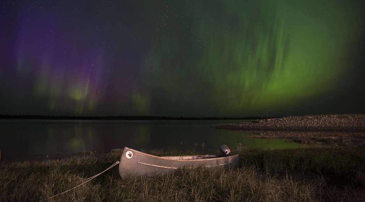
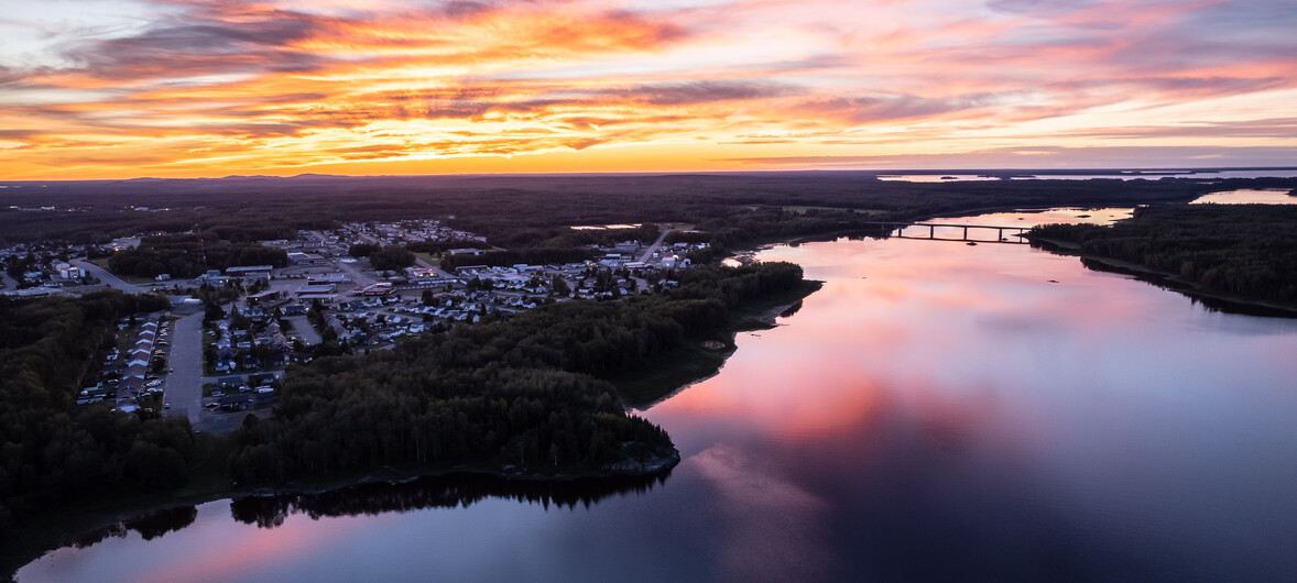
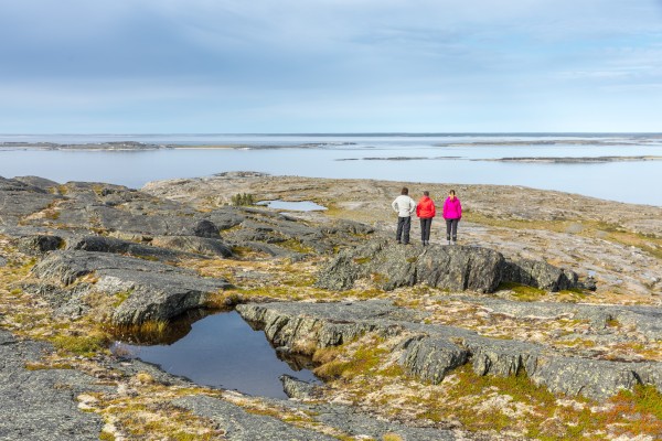
Eeyou Istchee Baie-James will amaze you. Its immense lakes, wild rivers, Northern Lights, seemingly endless forest, and wealth of wildlife are truly humbling.
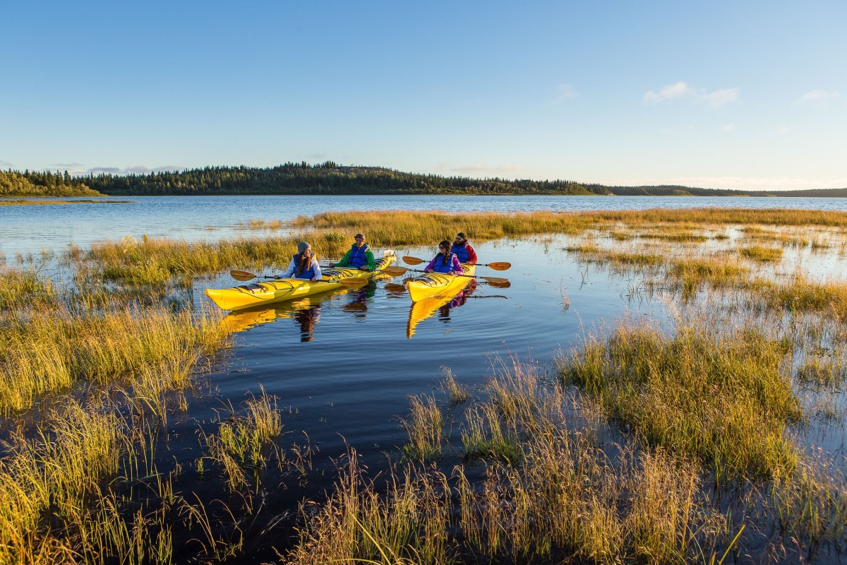
Discover covered bridges, witnesses of the past. Meet artisans and listen to native legends. Enjoy the many activities which take place here: fishing, camping, hiking or four-wheeling on trails, canoeing, kayaking, biking, climbing, rafting, etc. Hunting is the featured activity in autumn while in winter, the scenic snowmobile, cross country skiing and snowshoeing trails unveil new facets of the vast blank spaces of the Eeyou Istchee Baie-James region.
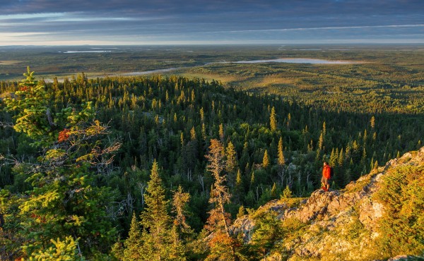
GREAT OUTDOORS
The Eeyou Istchee Baie-James region encompasses over 350,000 km² between the 49th and 55th parallels and covers about 600 km from east to west and about 600 km from south to north. In total, it represents one fifth of the province of Quebec. For comparison, the entire country of Germany covers 357 000 km².
Located roughly 800 kms north of Montreal, the region is bordered to the west by Ontario and James Bay, to the south by Abitibi-Temiscamingue and to the east by Saguenay-Lac-St-Jean regions. Finally, to the North by the Nunavik region.
Eeyou-Istchee Baie-James is home to some of the largest freshwater bodies in Quebec, truly inland seas. In fact, Mistassini Lake, formed by the passage of glaciers, is the largest natural freshwater lake in the province with a surface of 2,335 km². For their part, the La Grande Complex reservoirs represent the largest man-made bodies of water.
GEOMORPHOLOGY
The topography of the land is very representative of the Canadian Shield with its round-topped mountains, broad plateaus, and swampy plains. First formed by underwater volcanoes in the tropics, the ocean floor was later covered by tectonic plates, forming the northern part of the Canadian Shield. Evidence of this can be seen in the "pillow lava" and "breccia flows" that are still visible in some places in the north-eastern region. Their formation can be explained by the rapid cooling of the fiery underwater lava. The land formed the Témiscamie Otish Mountains, among other ranges. This demarcation defining the Grenville Front is used nowadays to divide the water between watersheds of James Bay and St. Lawrence. It is visible from the Chibougamau park around kilometer 188, as we go from green-coloured rock to pink-coloured rock. This limit is also used to delineate the Saguenay-Lac-St-Jean and the Eeyou Istche Baie-James region.
FLORA AND FAUNA
Two types of vegetation fashion the landscape of the region. The forest, almost impenetrable, is sprinkled with groves, hardwoods, and a wide variety of bushes and is brimming with edible plants and wild berries. A little further north, the undergrowth thins out, the hardwoods gradually disappear and the spruces become smaller in sizes and numbers; the boreal forest gives way to the taiga. The cladonia or caribou moss grows very slowly and it takes several years to form large green fronds that line the shallow soils and acidic region.
Despite its calm appearance, the forest is home to at least forty species of mammals, including wolves, lynx, foxes, bears, and moose. In the sky, sheltered beneath the twigs, perched on branches, or paddling on the waters, birds make their presence felt and their calls heard. Ducks, snow geese, snowy owls, eagles, falcons, ptarmigans, Canada geese, and loons figure among the birdlife of the region.
The abundance of its aquatic fauna is increasingly recognized and the diversity as well as the enormous size of certain specimens makes the region a real paradise for fishing enthusiasts. Anglers travel a long way to try their luck fishing for walleye, lake trout, brook trout, pike and other species in the crystal-clear waters of the territory.